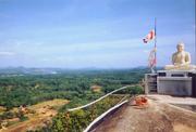
Homagama Area
History
According to the “Bodhiwansa” secrate bo-tree was planted by the king of Devanmpiyatissa in Ambulgama. (Ambalawa village)
Ancient legend shows the king of III Vijayabahu lived Ambulgama peek to protect from enemies.
The VI king of Prakramabahu was established in kotte kingdom rewarding the village and as a Kusalanagama donated a large paddy land at nawagamuwa area.(KERAGALA SANNASA )
The ambulgama temple was destroyed by the foreign enemies in several times ,and taken away valuable antique things. Now only the30 No of caves have been seen.
End of the seethawaka era some villages have been spreading in the region
In the mean time Lenagala Rajamaha viharaya was established. passing away the The king Walagmbahu had been some improvements. now only on ecave with “Kataram” carving (NAMPOTHA)
In between colonial period a large 33 estate such as Gulsonally, Mount Clifford,Temple burg Halbarawa ,Mattegoda group, cultivated Rubber, Coconut and other plantation.
Kelaniwali narrow gauge railway line passing away from colombo to opanayake in the region 1908
Elected local authority of village council were established in 1930
Highlevel road constructed in 1980
Patriac abacrombee was identifying Homagama as satellite town in 1948
Diayagama medium Wave retransmission stations was established in 1980
Homagama town council was established with 7 wards in 1963
Low level road constructed in 1978.
HomagamaPradeshiya shaba established in 1988
Identifying Homagama as a growth centre within the CMR structure plan
1978,1979,1983 and 1999 gazetted as a UDA declared area.
Source:
1. Chula vamsaya
2. Bodhi wamsya
3. Damadeni asna
4. Dalada poojawaliya
5. Pujawaliya
6. Rajawaliya
7. Ceylone fouvual of science
8. Section – G.11-p117 , 202 , 204 , 207 , 197
Archeological survey of ceylone Annual report – 42/1952
9. University of ceylone review Ix no, 1 – p20
10. Epigraphiya zelanica- vol iv No. 6 - p 50 , 58 21 - p 176-80 23 – p186-84
